



What you need to know
- Microsoft's Azure Orbital is now in preview, allowing users to communicate and control satellites from ground stations.
- Partnerships with SpaceEye and Microsoft's Project Turing can provide enhanced images of the ground from space.
- Airbus and Microsoft teamed up to add elevation data and high-res imagery into Azure.
Microsoft announced several partnerships and capabilities for Azure Space today, including work with Airbus, SpaceEye, and iDirect. Much of Microsoft's work centers around getting clearer images and information from satellites in space. Additionally, Azure Orbital is now in preview, letting users control satellites and communicate from ground stations around the globe.
Microsoft's own ground stations, as well as partner stations around the world, make it easier and more affordable to communicate with satellites. The Azure Orbital preview supports both KSATlite and Microsoft ground stations. The program allows customers to use antennas from these stations to communicate with satellites. Next year, ViaSat and USEI ground stations will also work with Azure Orbital.
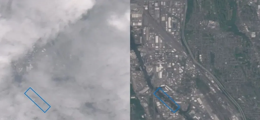
Because 67% of the earth is covered in clouds, getting clear images of the ground can be difficult. SpaceEye is an AI system that's built on Azure. It creates images of the earth every day without any clouds. A combination of data from radar and optical images are combined with image predictions from AI to create a representation of what the world looks like without clouds. These images can be used for agriculture, disaster response, and monitoring land.

Azure also powers technology that helps enhance images taken from space. Microsoft's Project Turing can create images that are comparable in resolution to shots taken from the air. One way this technology is used is to improve Bing Maps.
Microsoft partnered with Airbus to bring high-resolution satellite imagery and elevation data to Microsoft Azure Maps.
Esri, Blackshark.ai, and Orbital Insight also have new partnerships with Microsoft.
Previously, Microsoft worked with the International Space Station to accelerate research. The company also partnered with the South Australian government regarding space tech.

