


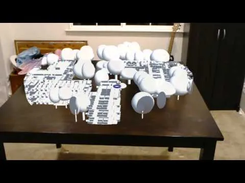
While there have been a number of demos of what developers can do with HoloLens, many of those have been presented at Microsoft events. A new video demonstrates what developers can do with the headset when left to their own devices. Coming from Romeriaux on YouTube, the video shows off a simple geographic information system (GIS) app running on the HoloLens, projecting a campus on a table as though it were actually there.
This is an interesting use of HoloLens that we haven't really seen before. GIS applications, often used to map out buildings or terrain, seem well-suited to use with an augmented reality headset. It's certainly a nice proof-of-concept, and we look forward to seeing what other independent developers can come up with for HoloLens.

