National Geographic World Atlas - Review

We’ve looked at dictionaries before, but the Windows Phone 7 Marketplace offers other reference applications as well. National Geographic World Atlas is one such program aimed at geography students and enthusiasts. And who doesn’t like learning about far away lands or the shape of the world?
National Geographic is one of the largest educational institutions in the existence. Does the mobile World Atlas live up to their usual high standards? Read on past the break to find out.
Diving into the details

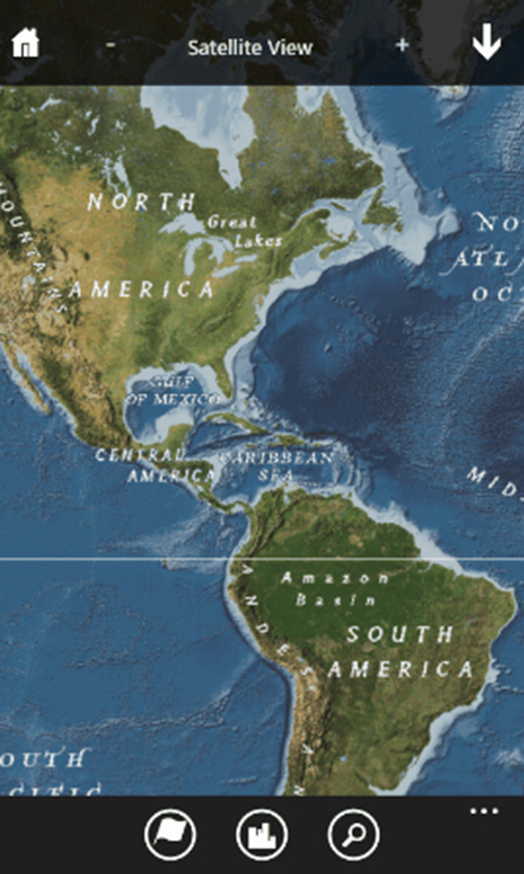
After launching National Geographic World Atlas, the user is greeted by a cylindrical map projection of the world. The map can be viewed in portrait or landscape modes. At any given time, the type of map can be toggled from a drop-down menu at the top of the screen. From this distant level of zoom, Political, Satellite, and Ocean Floor Views can be selected. Dragging or flicking scrolls the map, while the standard pinches zoom in and out.
Zoom, zoom, zoom!
This app offers an impressive level of zooming thanks to its online connectivity. Zoom in on the United States and it soon shows the borders of each state, their capitals, and major cities. The next level of zoom shows interstate highways, rivers and other bodies of water, major airports, and a large number of cities. Zoom further and the Atlas automatically switches to Road View. From here, you can magnify the map to such a level that individual streets appear (Road View is provided by Bing Maps). Toggle to Satellite View and you could even find your own house without much trouble - I can see kids having fun with this.
More than just maps
Get the Windows Central Newsletter
All the latest news, reviews, and guides for Windows and Xbox diehards.
World Atlas secondary menu hosts several useful features: Nations, Cities, Search, Bookmarks, My Location, and Help.

- Nations
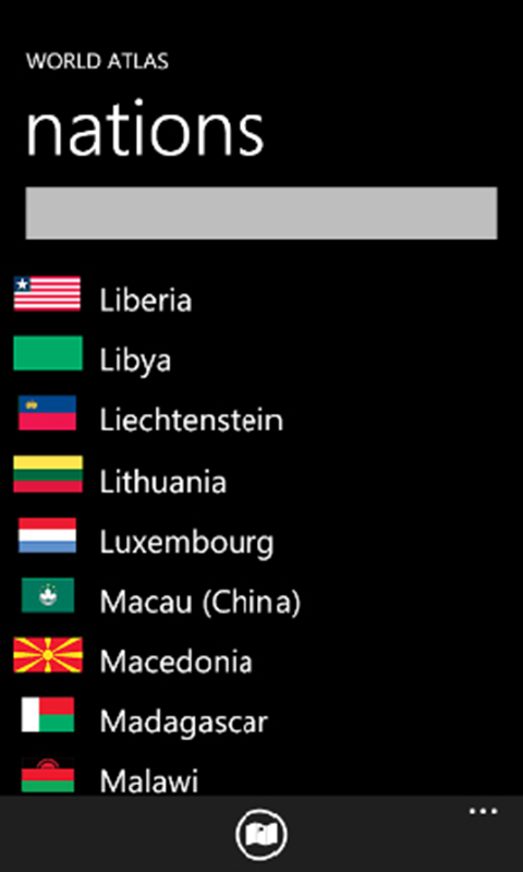
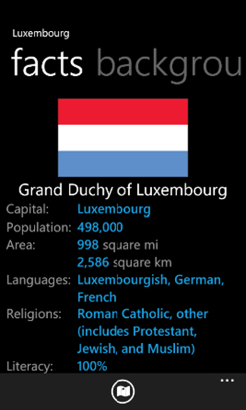
An alphabetical index of all the world’s nations. Each country’s entry lists three types of information: Facts (flag, population, government, languages, etc.); Background (a page or so of text); and Economy (currency, resources, exports, and more). The Nations menu is a great learning tool, and you can even jump to each country on the map. - Cities
An index of world cities. These take a long time to scroll through, but thankfully both Nations and Cities support the Windows Phone 7 feature of jumping to letters of the alphabet. Cities don’t have reference entries, so the only purpose of the directory is easily locating them on the map. Sadly, the Cities menu doesn’t work in landscape mode; it automatically switches to portrait. - Search
Search for and locate various things on the map: cities, counties, states, landforms, and more. United States searches provided the most useful results. When I searched for a major city in India, nothing came up. - Bookmarks
Any time you find a location on the map using the Nations, Cities, or Search tools, you can click and hold on that location to bookmark it. This is a handy way of keeping track of places you’ve researched. - My Location
World Atlas uses WP7’s GPS function to add a push pin to your location on the map. You can also bookmark the location. - Help
I’ve seen enough applications and games with no instructions or help whatsoever, so National Geographic’s Help section is much appreciated. It’s broken up into three sections. Instructions for Use describes exactly how to use the application. The bookmarking instructions neglect to mention that it’s necessary to hold a location’s push pin to bookmark it, but that’s the only mistake I found. About the Maps cursorily explains the maps’ origins and links to a website that sells them in printed form. Finally, Email a Suggestion allows users to launch a support email – a nice touch.

Bumps in the road
World Atlas has a lot going for it, but there are a few hitches. It requires an internet connection, so it won’t be of as much use to people who turn off their Data Connections on the go. Load times when switching zoom levels or jumping to map locations are noticeable and occasionally excruciating, probably a byproduct of the maps being stored online instead of within the application itself. Regardless, the Atlas should keep things the user has already seen in memory, but it doesn’t.
There are also some issues with zooming. I would like another way of zooming besides pinch controls. Starting from the default view and magnifying to street level requires repeated pinches, whereas a slider or some other method could accomplish the same thing in fewer steps. The program sometimes misinterpreted my pinches, switching its focus to the nation’s capital instead of the place I was trying to magnify.
Overall Impression
National Geographic World Atlas for Windows Phone 7 is a thorough and impressive application. Its many features make learning easy and fun. The load times are just unacceptable though; a speed boost is desperately needed. The development team apparently takes user feedback very seriously and there have been a few updates so far, so performance will hopefully improve over time. I still recommend it to anyone with an interest in Geography, provided the title’s internet requirement won’t prevent them from being able to use it when they need it.
National Geographic World Atlas has a free trial with a limited feature set that doesn't really speak for the application's quality. The full version costs $2.99. You can find it here (opens your Zune software) in the Marketplace.
Paul Acevedo is the Games Editor at Windows Central. A lifelong gamer, he has written about videogames for over 15 years and reviewed over 350 games for our site. Follow him on Twitter @PaulRAcevedo. Don’t hate. Appreciate!

