Windows Phone Store Collection: The Great Outdoors
All the latest news, reviews, and guides for Windows and Xbox diehards.
You are now subscribed
Your newsletter sign-up was successful
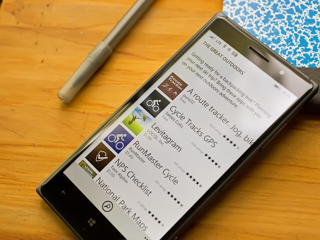
The Windows Phone Store is packed full of top notch apps designed to help monitor and manage our outdoor activities. You have a host of apps designed to track and monitor our fitness activities, as well as those that simply can help us enjoy being outdoors.
Fall colors are beginning to show and with the weather getting cooler, many will be hitting the trails. The Windows Phone Store Collection, The Great Outdoors, is a small sampling of apps designed to help you with your hikes, biking outings or any other outdoor activities you are planning.
This week's roundup focuses solely on apps in the Great Outdoors Collection. There are plenty other quality apps in the Store to help you with your outdoor activities that did not make the Collection. Just to name a few, you haveOutdoor Navigation, Endomondo and Maaloo Outdoor. If your favorite outdoor app didn't make the collection, feel free to sound off in the comments below with your recommendation.
Hike & Bike
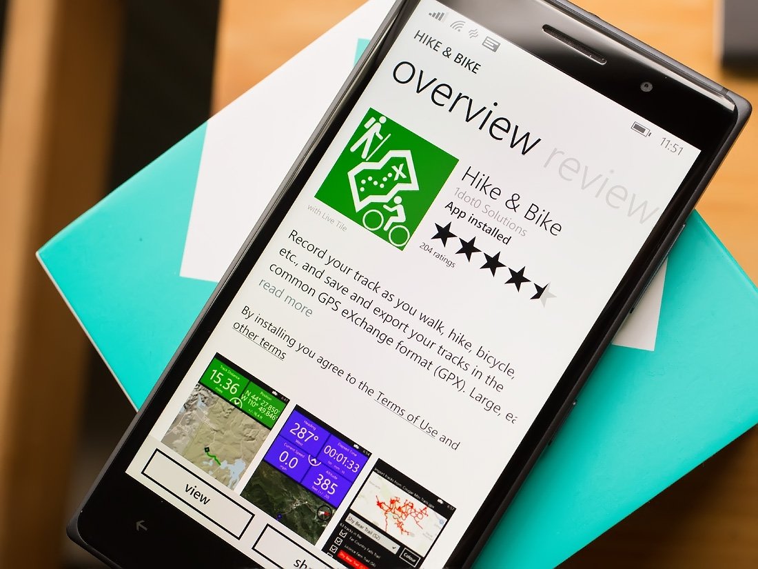
Many will be taking to the great outdoors to catch the Fall colors and the Hike & Bike Windows Phone app is available to track your walks, hikes and biking adventures.
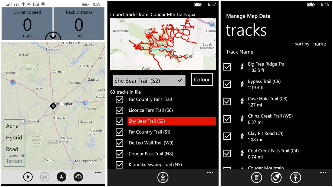
The app is rated at 4 Stars in the Windows Phone Store and is a rather simple tracking app. Hike & Bike opens up to a map view with control buttons lining the bottom of the screen. These buttons allow you to start recording your track, save your track, center the map on your location and view your speed and distance.
Map views include Aerial, Hybrid, Road and Terrain layers. Hike & Bike has support to back up your tracks to OneDrive and you can import trails that are in GPX format. Saved tracks can be reviewed from the "Manage Track Data" option that is on the three-dot menu. Saved tracks will map your route with detailed information such as start/stop times, distance traveled, average speed altitude.
In exploring the Windows Phone app for a short time, Hike & Bike comes across as a simple, easy to use app to record your outdoor activities. I can see it being useful for hikers, bikers, kayakers or anyone else wanting to record their outdoor routes. It will not track calories burned or other fitness stats that other tracking apps may such as Endomondo.
All the latest news, reviews, and guides for Windows and Xbox diehards.
Hike & Bike is a free app, but has some limitations. You can only import ten tracks, save ten tracks and export ten tracks. To remove these restrictions you will need to unlock the unlimited tracks feature in the settings, which is oddly a free upgrade. We aren't sure if this is a typo or a promotional offer, but if Hike & Bike is something of interest you may want to jump on this freebie while it is still around.
Download Hike & Bike from the Windows Phone Store (Free)


Jack of Tools
Jack of Tools is a Swiss Army Knife of sorts for your Windows Phone. It contains a collection of virtual tools that can help you navigate around the great outdoors, as well as any other location.
The Windows Phone app contains a LED flashlight, compass, virtual level, a coordinate finder, an altimeter, a speedometer, a track back tool, a caliper, a magnifier, a light meter and a sound meter.
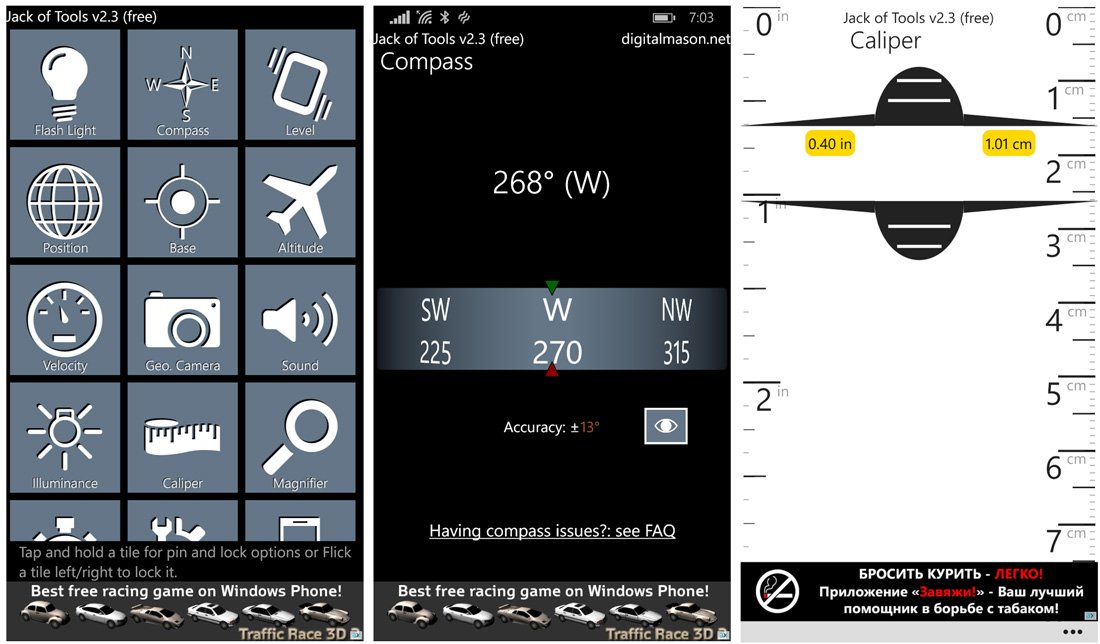
Individual tools can be pinned to your Windows Phone Start Screen and the free version of Jack of Tools provides you access to the core features of each tool. If you want to unlock the full feature set, it'll cost you $1.99 to buy the Pro version.
The Pro version will give you the ability to run the flashlight under a lockscreen, transparent or look through compass mode, level calibration, save up to fifty base locations and more. In upgrading to the Pro version, you will also lose the ad-support.
In just tinkering around with Jack of Tools it is a user-friendly utility app that can come in handy around the campsite or around the house.
- Download Jack of Tools from the Windows Phone Store (Free)
- Download Jack of Tools from the Windows 10 Store (Free)

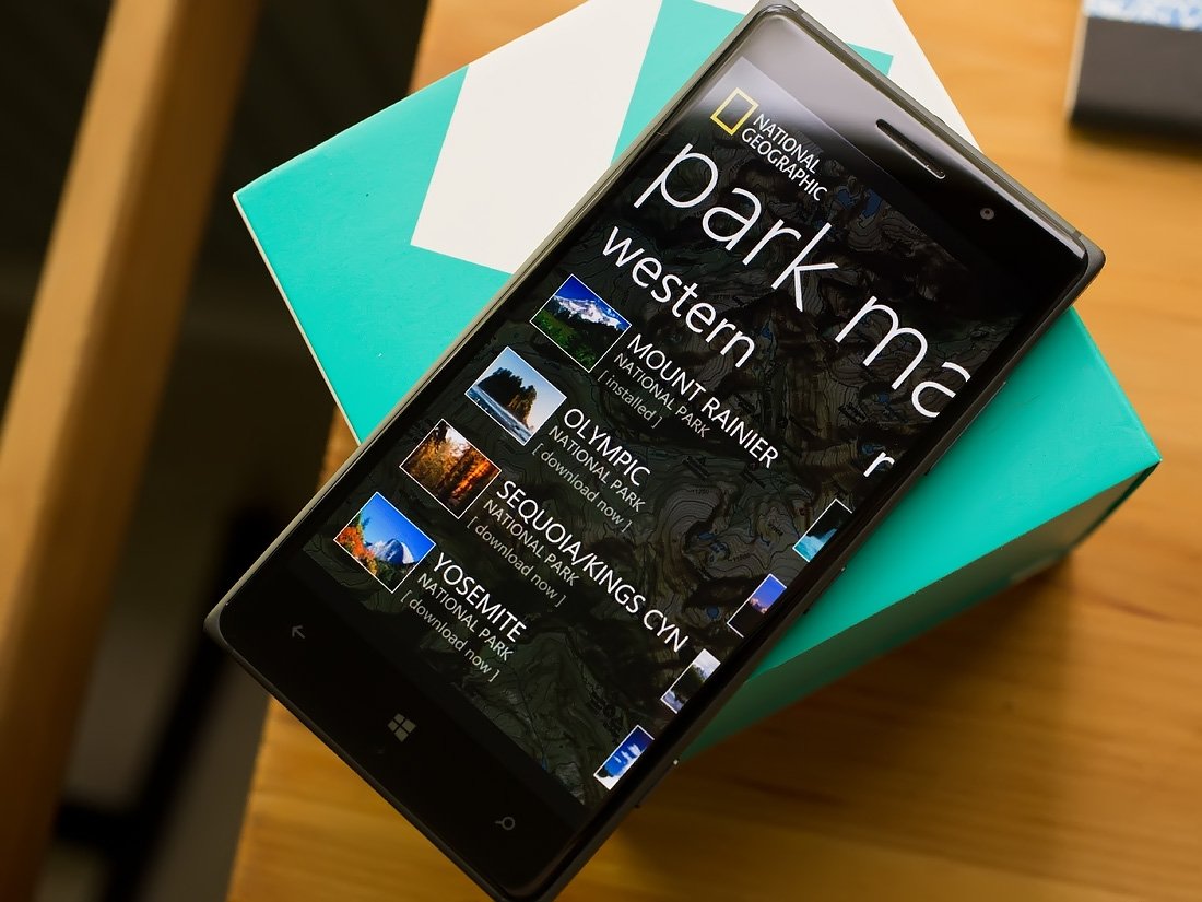
National Park Maps
U.S. National Parks are popular tourist attractions and finding your way around the parks can be a challenge. The National Park Maps app for Windows Phone is a collection of fifteen of the more popular National Parks.
The app and maps are the product of National Geographic and cover the following National Parks: Acadia Bryce, Canyon, Canyonlands, Glacier/Waterton, the Grand Canyon, Grand Teton, Great Smokey Mountains, Mount Ranier, Olympic National, Rocky Mountain, Sequoia/Kings Canyon, Shenandoah, Yellowstone, Yosemite and Zion.
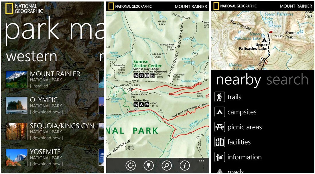
The maps have support for your Windows Phone Location Services to highlight your current position on the map, includes a powerful search engine to find places by name or category and there is support for offline access by downloading the maps locally.
The National Park Maps app comes across as a great way to find your way around these parks, locate campgrounds, trials, Ranger stations and other points of interest. The only downside to the National Park Maps app is that there is no trial version available. The full version will cost you a $1.99, which is in many ways a steal considering the volume of maps you have access to.
Download National Park Maps from the Windows Phone Store ($1.99)

GeoCaching Live
Geocaching is a popular outdoor past-time where you hunt down or hide treasure using a GPS to guide you along the way. GeoCaching Live is a Windows Phone app that taps into the Geocaching community that spans more than 185 Countries and millions of caches to hunt down.
GeoCaching Live does require, at minimum, a Basic Membership account. The Basic Membership is free and provides you access to the full app but with slight usage restrictions.
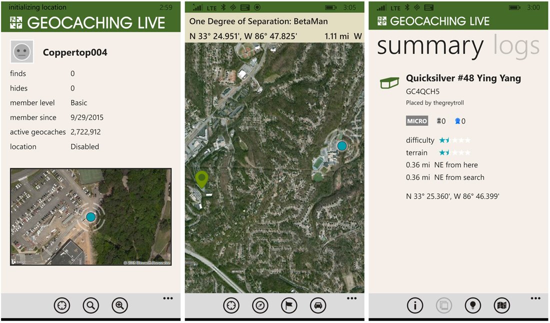
Key features of GeoCaching Live include:
- Access to over two million geocaches around the World
- Create custom waypoints for solving Mystery and Multiple caches
- Geocache finds can be logged and photographed
- Save offline geocache lists
- Live Tile support
GeoCaching Live provides you unlimited lite geocache data and full geocache data for three geocaches per day. The full data includes the summary, logs, notes, hints and trackables associated with the geocache. The lite data only provides access to the summary page of the cache. All cache listings will have a map view available and geocache locations can be downloaded for offline tracking.
The Premium Membership will cost you $30 annually and provides you with full data searches for geocaches for up to 6,000 caches a day.
Geocaching Live does look like an appealing outdoor app and if you have tried GeoCaching Live, let us know what you think of things in the comments below. It is a free Windows Phone app that does have slight usage restrictions.
Download GeoCaching Live from the Windows Phone Store (Free)


George is a former Reviews Editor at Windows Central, concentrating on Windows 10 PC and Mobile apps. He's been a supporter of the platform since the days of Windows CE and uses his current Windows 10 Mobile phone daily to keep up with life and enjoy a game during downtime.
